Nestled in the heart of the Canadian Rockies, Banff National Park stands as a testament to nature’s grandeur and a playground for outdoor enthusiasts seeking authentic wilderness experiences. This UNESCO World Heritage Site encompasses over 6,640 square kilometres of pristine alpine terrain, featuring towering peaks that exceed 3,000 metres, crystalline lakes carved by ancient glaciers, and ecosystems that harbour some of North America’s most iconic wildlife species. The park’s diverse topography creates opportunities for activities ranging from technical mountaineering expeditions to gentle valley walks, making it accessible to adventurers of all skill levels whilst maintaining its reputation as one of the world’s premier outdoor destinations.
The convergence of accessible infrastructure and untamed wilderness in Banff creates unparalleled opportunities for outdoor recreation throughout the year. From the technical challenges of multi-pitch climbing routes on limestone faces to the serene paddling experiences along glacier-fed waterways, the park’s activity spectrum caters to both adrenaline seekers and nature contemplatives. Understanding the specific requirements, seasonal considerations, and safety protocols for each activity ensures that your time in this remarkable landscape becomes both memorable and secure.
Alpine hiking trails and Multi-Day trekking routes
The hiking infrastructure within Banff National Park represents decades of careful trail development designed to showcase the region’s most spectacular alpine environments whilst minimising ecological impact. The trail network spans over 1,600 kilometres, ranging from accessible valley floor routes suitable for families to demanding backcountry traverses that challenge even experienced mountaineers. Trail classifications follow standardised difficulty ratings, with Class 1 representing well-maintained paths requiring no technical skills, whilst Class 4 routes demand scrambling abilities and route-finding expertise.
Seasonal timing significantly influences trail accessibility and conditions throughout the park. High-altitude routes typically remain snow-covered until mid-July, with optimal hiking conditions occurring between July and September. Weather patterns can change rapidly in alpine environments, with afternoon thunderstorms common during summer months. Essential preparation includes layered clothing systems, navigation equipment, emergency shelter, and communication devices for remote areas.
The alpine environment in Banff demands respect and preparation, as conditions can shift from benign to life-threatening within minutes, particularly above the treeline where exposure to elements becomes a critical safety factor.
Plain of six glaciers trail: technical route analysis and elevation profiles
This demanding 14.4-kilometre return journey from Lake Louise presents one of the park’s most rewarding high-alpine experiences, culminating at an elevation of 2,135 metres. The route follows the original path constructed by Swiss guides in the early 1900s, traversing moraines deposited by the retreating Victoria Glacier system. The initial 3.6 kilometres maintain a gentle gradient along the lake’s northern shore before ascending steeply through avalanche debris fields and unstable rock formations.
Technical considerations include navigating loose scree sections where proper foot placement becomes crucial for maintaining stability. The final approach to the tea house involves crossing glacier-fed streams that fluctuate dramatically throughout the day, with morning crossings generally offering more stable conditions. Elevation gain totals 365 metres, with the steepest sections occurring in the final 2 kilometres where the trail switchbacks through alpine meadows.
Skyline trail: backcountry navigation and wilderness camping protocols
The Skyline Trail represents Banff’s premier multi-day trekking experience, spanning 44 kilometres through the Maligne Range with designated backcountry campsites requiring advance reservations. This route demands proficient map and compass navigation skills, as weather conditions frequently obscure trail markers above the treeline. The trail’s highest point reaches 2,485 metres at Curator Col, where alpine exposure requires careful timing to avoid afternoon lightning risks.
Wilderness camping regulations mandate the use of designated sites equipped with bear-proof food storage and composting toilet facilities. Campers must demonstrate proficiency in Leave No Trace principles, including proper waste disposal, minimal campfire impact, and wildlife interaction protocols. Water sources along the route require treatment, with filtration or purification tablets essential for preventing waterborne illnesses common in alpine environments.
Valley of the five lakes: geological formations and trail difficulty classifications
Classified as an easy to moderate circuit, the Valley of the Five Lakes trail offers a valuable introduction to Banff’s glacial geomorphology without the sustained elevation gain of higher alpine routes. The 4.5-kilometre loop undulates gently through mixed forest, crossing ancient glacial moraines that now support mature lodgepole pine and spruce stands. Each of the five lakes exhibits distinct shades of emerald and turquoise, created by varying concentrations of rock flour and suspended minerals left behind as Pleistocene-era glaciers retreated. Trail surfaces are predominantly compacted dirt with occasional rooty sections and short rocky outcrops, making sturdy hiking shoes advisable but not requiring technical equipment.
Difficulty ratings generally place this route in the Class 1–2 range, suitable for most visitors with basic fitness and mobility. The minimal elevation gain of approximately 120 metres is spread across several short climbs, enabling frequent rest stops at lakeside viewpoints without compromising progress. As with all popular day hikes in Banff National Park, hikers should remain on designated paths to protect fragile shoreline vegetation and prevent erosion, particularly near the narrow isthmuses between lakes. For those building up to longer alpine hikes, the Valley of the Five Lakes provides an ideal environment to test pacing strategies, pack weight, and layering systems in a relatively controlled setting.
Sentinel pass via larch valley: alpine zone acclimatisation techniques
Sentinel Pass via Larch Valley is one of Banff National Park’s most celebrated alpine hikes, renowned for its golden larch displays in late September and expansive views over the Paradise Valley and Ten Peaks. The route begins at Moraine Lake and climbs approximately 730 metres over 11.6 kilometres return, transitioning from dense subalpine forest to open larch meadows and finally to a high, exposed pass at 2,611 metres. This rapid elevation gain over a short horizontal distance can challenge visitors who are not yet acclimatised to high-altitude hiking. As you ascend, lower oxygen levels and increased UV exposure can subtly affect decision-making and physical performance, even on clear days.
Effective acclimatisation starts before you set foot on the trail. Spending one to two days at intermediate elevations (around 1,300–1,600 metres in Banff townsite or Lake Louise) allows your body to adjust to reduced oxygen levels. On the hike itself, adopting a measured pace—especially on the sustained switchbacks above Larch Valley—helps regulate heart rate and breathing, reducing the risk of altitude-related headaches and fatigue. Hydration plays a critical role: aim to drink small amounts consistently rather than waiting until you feel thirsty, as dry mountain air accelerates fluid loss through respiration. Think of acclimatisation as tuning an engine for thinner air; you want to avoid redlining your system early in the day.
Above the treeline, exposure to wind, sun, and sudden temperature shifts increases dramatically. Layered clothing systems that include a moisture-wicking base, insulating mid-layer, and windproof, waterproof shell enable rapid adjustments as conditions change. Many hikers underestimate how quickly weather can deteriorate at Sentinel Pass, where snow squalls and wind gusts can arrive within minutes. Early starts not only reduce crowd levels but also decrease the likelihood of encountering afternoon thunderstorms, which are particularly hazardous on the open scree slopes below the pass. If mild symptoms of altitude discomfort appear—such as light headache or unusual breathlessness—slowing your pace, resting, and hydrating often resolve them; persistent or worsening symptoms are a clear signal to descend to lower elevation.
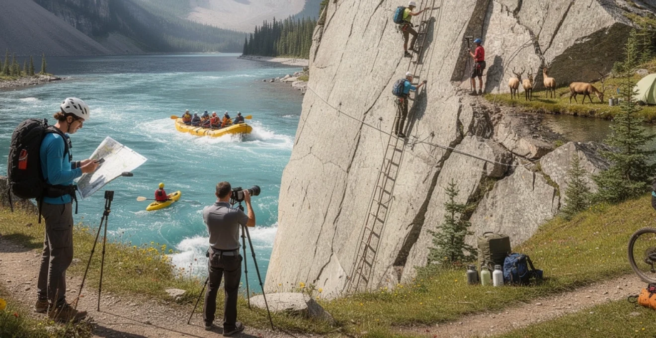
Rock climbing and via ferrata technical ascents
Banff National Park and the surrounding Bow Valley corridor are internationally recognised for their limestone and quartzite cliffs, offering everything from single-pitch sport lines to committing alpine routes. The region’s climbing infrastructure has evolved substantially over the past three decades, with bolted sport crags, established traditional lines, and professionally guided via ferrata routes creating options for a wide range of skill levels. However, the same rugged geology and variable mountain weather that make this landscape so impressive also introduce objective hazards such as rockfall, loose blocks, and sudden storms.
Climbers visiting Banff must understand that this is a mountain environment first and a climbing destination second. Routes can feel more serious than their numerical grades suggest due to length, exposure, and the potential for changing conditions. Helmet use is standard rather than optional, and careful route selection based on your team’s experience is essential. For those new to the area, hiring an ACMG (Association of Canadian Mountain Guides) certified guide or joining an instructional course provides not only technical coaching but also local knowledge about seasonal conditions, descent routes, and current access considerations.
Mount rundle east end of rundle (EEOR): multi-pitch sport climbing routes
The East End of Rundle (commonly referred to as EEOR) overlooks the town of Canmore at the southeastern boundary of Banff National Park and offers some of the most accessible multi-pitch sport climbing in the region. Its south-facing limestone walls host routes up to 300 metres in length, with grades typically ranging from 5.7 to 5.11. Approaches are steep and can involve loose scree, so many parties allocate 45–90 minutes to reach the base, depending on fitness and familiarity. The combination of sustained pitches and complex descents means that EEOR objectives are best suited to competent multi-pitch leaders comfortable with route-finding and efficient rope management.
Technical considerations on EEOR revolve around protection spacing, rock quality, and retreat options. While many routes are bolted, spacing can feel longer than at typical indoor gyms or sport crags, requiring confident movement above gear. The limestone here is often solid but can include sections of fractured rock and small flakes that should be tested before committing weight. Parties should carry twin or half ropes for full-length rappels, a standard sport rack with additional slings for extending draws and building anchors, and a lightweight emergency kit including headlamps, extra insulation, and a compact first-aid kit. Starting early and monitoring weather forecasts closely is crucial, as afternoon thunderstorms can transform the upper pitches and descent gullies into hazardous terrain.
Ha ling peak scrambling: class 3 terrain navigation and safety protocols
Ha Ling Peak, located just outside the Banff National Park boundary near Canmore, is one of the Bow Valley’s most popular introductory scrambles. The standard route follows a well-defined trail to the saddle before transitioning to Class 2–3 terrain on talus and broken rock leading to the summit ridge at 2,407 metres. Although technically non-glaciated and generally free of exposure compared to technical climbs, the upper section demands careful foot placement, route-finding skills, and an understanding of loose-rock hazards. Many incidents on Ha Ling involve slips on unstable scree or rockfall triggered by parties travelling too closely together.
Navigating Class 3 terrain safely requires adopting a deliberate, three-point-contact movement style and assessing the stability of each hold before weighting it. Think of the slope as a conveyor belt of loose material: you want to move in a way that barely disturbs it, rather than kicking rocks downslope. Helmets are strongly recommended above the tree line, especially on busy days when multiple groups share the same ascent line. Parties should maintain spacing of several metres between climbers on steep sections to reduce the risk of rockfall injuries. In shoulder seasons, snow or verglas can linger on shaded aspects, rapidly increasing difficulty; traction devices and trekking poles can provide added security, but knowing when to turn around is the most important safety protocol of all.
Because Ha Ling is perceived as a “beginner summit,” it often attracts hikers who underestimate alpine conditions. Sudden temperature drops and strong winds are common on the exposed ridge, even when the valley below remains warm. Carrying a windproof layer, gloves, and a warm hat is advisable year-round, and navigation tools (map, GPS, or offline mapping app) become critical when cloud cover reduces visibility. Before you go, ask yourself: if visibility dropped to 20 metres, could you confidently retrace your steps back to the main trail? If the answer is uncertain, consider starting with a lower-commitment objective or joining a guided scrambling course.
Mount cascade north face: traditional climbing anchor systems
Mount Cascade’s imposing north face rises dramatically above the Trans-Canada Highway and the town of Banff, offering serious alpine rock and mixed routes for experienced traditional climbers. Routes on this aspect can exceed 600 metres in length, with complex sections of crack systems, ledges, and occasional loose bands requiring advanced judgement in both movement and protection. Unlike bolted sport crags, climbers here must construct reliable anchors in varied rock using a combination of cams, nuts, hexes, and natural features. The ability to quickly assess rock quality—looking for sound, crystalline limestone versus weathered, fractured layers—is pivotal to building safe anchor systems.
Effective traditional anchor systems on Cascade follow the established principles of being solid, equalised, and redundant. In practice, this often means combining three or more independent pieces of protection, oriented to distribute load along the anticipated direction of pull. For example, a typical belay anchor might incorporate a medium cam in a vertical crack, a nut in a constricting seam, and a sling around a horn, all linked with a cordelette to equalise forces. Climbers must also consider the potential for downward and outward forces during both belaying and rappelling, adjusting placements accordingly. Given the length and seriousness of Cascade routes, many teams carry double sets of cams in key sizes, a full nut rack, extra slings, and at least one tagline or second rope for retreat.
Objective hazards on the north face include rockfall, lingering snow patches well into summer, and rapidly shifting weather. Because descent routes can be complex and time-consuming, efficient stance management and clear communication are as important as technical anchor-building skill. Parties should plan conservative turnaround times and be prepared for unplanned bivouacs with emergency insulation, a lightweight shelter, and extra food and water. In this environment, well-constructed anchors are analogous to a seatbelt system in a high-performance vehicle: you may never need to test them to their limits, but their integrity is non-negotiable when things go wrong.
Tunnel mountain via ferrata: fixed-route hardware and harness specifications
The Tunnel Mountain via ferrata conceptually mirrors similar protected climbing routes in the European Alps, utilising fixed steel cables, rungs, and ladders to facilitate safe passage across steep terrain. While several via ferrata routes in the Bow Valley are more commonly associated with Mount Norquay, the principles of equipment use and hardware inspection remain consistent across installations. Participants are secured to a continuous safety cable using a dedicated via ferrata lanyard system incorporating energy absorbers designed to reduce impact forces in the event of a fall. This setup allows individuals with limited climbing experience to access exposed viewpoints while maintaining a high margin of safety under professional supervision.
Harness specifications for via ferrata activities generally mirror those used in rock climbing, with sit harnesses featuring adjustable leg loops and secure double-back buckles. The critical difference lies in the lanyard system: UIAA- and EN-certified via ferrata sets include two locking carabiners attached to an energy-absorbing unit, often using tear-webbing technology that gradually deploys under high loads. Users clip alternately between cable segments, ensuring that at least one carabiner remains attached at all times. Helmets meeting UIAA or CE standards are mandatory due to the potential for rockfall, dropped equipment, or unintentional contact with the rock surface. Before departure, guides typically conduct a comprehensive equipment check, verifying correct harness fit, proper lanyard attachment to the belay loop, and functional carabiner gates.
Fixed-route hardware—including anchor bolts, intermediate cable anchors, and ladder attachments—is subject to regular inspection and maintenance by qualified technicians. Nonetheless, participants should be trained to visually assess components for obvious signs of wear, corrosion, or damage, and to report any concerns immediately. Weight limits published by operators (often in the 40–120 kg range for via ferrata systems) must be strictly observed to ensure that energy absorbers function as designed in a fall. As with all guided activities in Banff National Park, route availability is season-dependent, with snow, ice, and lightning risk dictating operating windows. In poor weather or if you feel uncomfortable with exposure, communicating openly with your guide enables route adjustments or early exits that keep safety paramount.
Winter sports and cold-weather activity specialisations
Winter in Banff National Park transforms the landscape into a world-class destination for cold-weather sports, with reliable snowpack typically from late November through April. Downhill skiing and snowboarding dominate at nearby resorts such as Sunshine Village, Lake Louise Ski Resort, and Mount Norquay, which collectively offer over 8,000 acres of skiable terrain and some of the most consistent powder conditions in the Canadian Rockies. Beyond lift-served terrain, cross-country skiing, snowshoeing, and ski touring open up quieter valleys and frozen lakes for those seeking solitude. Each discipline carries its own technical requirements, from avalanche education for backcountry skiers to proper layering and traction devices for winter hikers on popular trails like Johnston Canyon.
Cold-weather activity in Banff is fundamentally an exercise in thermal management and risk mitigation. Ambient temperatures can plunge below -20°C, with wind chill intensifying exposure on ridgelines, open lakes, and chairlifts. A well-planned winter kit includes moisture-wicking base layers, insulating mid-layers such as fleece or synthetic jackets, and waterproof outer shells, complemented by insulated gloves, liners, neck gaiters, and goggles or sunglasses to protect against snow glare. For winter hiking and ice walks, traction aids (microspikes or crampons) and trekking poles dramatically improve stability on packed snow and icy surfaces. Ice cleat rentals are widely available in Banff and Lake Louise, making it easy for visitors to access iconic locations like frozen waterfalls and lakes safely.
Avalanche awareness is indispensable for anyone venturing beyond groomed resort boundaries or marked winter trails. Parks Canada publishes a daily avalanche bulletin for the Banff, Yoho, and Kootenay region, categorising hazard levels from Low to Extreme based on snowpack analysis and weather trends. Backcountry skiers, snowboarders, and splitboarders should carry, at minimum, a modern transceiver, probe, and shovel, and possess formal avalanche training such as AST 1 (Avalanche Skills Training). Even snowshoers and winter hikers can unknowingly enter avalanche terrain if they stray from designated routes, underlining the importance of terrain recognition skills and conservative decision-making. In winter, the mountains can feel like a beautiful frozen laboratory where physics, weather, and human judgement intersect; understanding those dynamics is what turns a good day out into a safe one.
Whitewater rafting and paddle sports on bow river system
During the ice-free months, the Bow River and its tributaries provide varied opportunities for whitewater rafting, kayaking, and canoeing, ranging from gentle float trips to exhilarating Class III rapids. Commercial rafting operators commonly run sections such as the Horseshoe Canyon and Kananaskis River (just outside Banff National Park), which offer controlled yet exciting introductions to whitewater environments. Within the park, the Bow River near Banff townsite and Lake Louise is more typically used for scenic paddling and wildlife viewing, with slower currents and broad channels. Regardless of river section, participants must approach moving water with respect, recognising that cold temperatures and swift currents can rapidly escalate minor errors into serious incidents.
Technical considerations in whitewater rafting on the Bow River system revolve around river classification, flow rates, and water temperature. Spring snowmelt can significantly increase river discharge, raising rapid difficulty by one grade or more compared to late summer levels. Operators monitor hydrometric data published by Water Survey of Canada to guide trip decisions and adjust safety protocols. Wetsuits or drysuits, helmets, and correctly fitted personal flotation devices (PFDs) are standard equipment for guided trips, with additional layers recommended on colder days. For independent paddlers, self-rescue skills, throw-bag proficiency, and an understanding of river hazards such as strainers, undercut banks, and hydraulics are essential competencies.
Flatwater paddling on sections of the Bow River near Banff and on nearby lakes like Two Jack and Minnewanka offers a more contemplative counterpart to whitewater rafting. Here, wind becomes as important a factor as current, especially in the afternoon when thermal breezes strengthen. Planning routes that travel upwind early and return with a tailwind can significantly reduce fatigue and improve safety margins. Cold-water immersion remains a serious risk even in midsummer, with hypothermia possible within minutes if appropriate clothing and rescue plans are lacking. Viewed through a safety lens, effective paddle sports in Banff resemble a well-choreographed dance with the river: when you understand its rhythms and boundaries, the experience becomes both exhilarating and secure.
Wildlife photography and ecological observation techniques
Banff National Park’s status as a core habitat for species such as grizzly bears, wolves, elk, and bighorn sheep makes it a prime destination for wildlife photography and ecological observation. Ethical viewing practices underpin all wildlife-focused activities, both for personal safety and for the long-term health of animal populations. Parks Canada recommends minimum viewing distances of 30 metres for most wildlife and 100 metres for bears, with further separation required if animals show signs of stress or altered behaviour. Telephoto lenses (200 mm and above) and binoculars allow photographers and observers to maintain these distances while still capturing high-quality images and behavioural details.
Successful wildlife photography in Banff blends fieldcraft with technical camera skills. Dawn and dusk—known as the golden hours—often coincide with peak animal activity and the most favourable light conditions. Positioning yourself downwind and minimising noise and sudden movement reduces the likelihood of disturbing animals or altering their natural behaviour. In practice, this might mean parking at a safe distance, remaining inside your vehicle on roadside sightings, and using beanbags or window mounts to stabilise long lenses. For backcountry encounters, keeping cameras easily accessible but securely stowed ensures you can respond quickly without fumbling for equipment in bear country.
Ecological observation goes beyond simply identifying species; it involves understanding habitat use, seasonal movements, and interspecies interactions. Carrying a field guide to Rocky Mountain flora and fauna or using naturalist apps can help you document observations, contributing to citizen science projects where appropriate. When photographing sensitive habitats such as alpine meadows or wetlands, staying on marked trails and durable surfaces protects fragile plant communities that may take decades to recover from trampling. Think of yourself as a guest in a living museum: your goal is to leave every exhibit exactly as you found it, with only digital images and field notes as your souvenirs.
Cycling infrastructure and mountain biking trail networks
Cycling in and around Banff National Park has expanded significantly in recent years, supported by dedicated pathways, multi-use trails, and regional initiatives that promote low-impact transportation. The legacy trail between Banff and Canmore—a 27-kilometre paved route paralleling the Trans-Canada Highway—serves as the backbone of the local cycling network, providing a safe corridor for touring cyclists and recreational riders alike. Within the park, additional paved and gravel routes connect campgrounds, viewpoints, and trailheads, reducing reliance on motor vehicles and offering a more immersive way to experience the landscape. E-bikes are permitted on many of these corridors, though riders should verify current regulations regarding specific routes and park rules.
Mountain biking opportunities in the broader Banff and Bow Valley region range from family-friendly forest paths to technical singletrack with steep climbs and descents. Trails are typically rated using familiar difficulty categories—green, blue, black—similar to ski runs, allowing riders to choose terrain that matches their skills and fitness. Many routes feature natural obstacles like roots, rocks, and tight switchbacks rather than constructed features, reflecting the park’s emphasis on minimal-impact trail design. Before heading out, riders should consult current trail condition reports to avoid areas affected by seasonal closures, bear activity, or wet-weather damage. Riding on closed or saturated trails accelerates erosion and can lead to long-term access restrictions.
For longer excursions, road cyclists often incorporate the Bow Valley Parkway (Highway 1A) and sections of the Icefields Parkway into multi-day itineraries, attracted by relatively low traffic volumes and world-class mountain scenery. Seasonal vehicle restrictions on portions of these roads at certain times of year can create near-car-free experiences, though schedules and regulations change regularly and must be checked in advance. Regardless of discipline, core safety practices—including wearing a helmet, using daytime running lights on roads, and carrying basic tools and spares—are non-negotiable. In bear country, cyclists should also make regular noise, avoid high-speed travel in low-visibility areas such as tight corners or dense forest, and consider carrying bear spray easily accessible on a hip belt or handlebar mount. When approached with preparation and respect, cycling in Banff becomes more than transport; it is an integrated way to engage with the park’s ecosystems, geology, and ever-changing mountain light.