Iceland’s dramatic landscapes—from thundering waterfalls and black sand beaches to sprawling glaciers and geothermal hot springs—have captivated independent travellers for decades. The allure of self-guided exploration across this remote North Atlantic island has only intensified as infrastructure improvements and digital mapping tools have made autonomous travel more accessible than ever. Yet the question remains: can you truly experience Iceland’s wild beauty without the structure and local expertise of organised tours?
The answer is a resounding yes, provided you approach the journey with thorough preparation and realistic expectations. Iceland’s well-maintained Ring Road encircles the entire country, connecting most major attractions whilst offering countless opportunities for spontaneous detours. The freedom to set your own pace, linger at landscapes that speak to you, and venture beyond the tourist-heavy Golden Circle route represents an increasingly popular alternative to coach-based excursions. However, this independence comes with responsibilities: understanding vehicle requirements for challenging terrain, interpreting weather alerts that can change hourly, and budgeting accurately for one of Europe’s most expensive destinations.
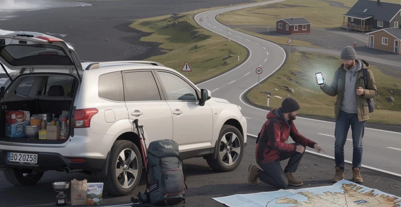
Planning your Self-Drive itinerary along iceland’s ring road
Route 1, commonly known as the Ring Road, forms the backbone of any self-guided Icelandic adventure. This 1,332-kilometre circuit connects Reykjavík to the country’s most accessible natural wonders whilst threading through fishing villages, agricultural valleys, and volcanic deserts. The circular nature of this route allows travellers to begin and end in the capital, eliminating the logistical complications of one-way vehicle rentals or backtracking across vast distances. Most independent explorers allocate between seven and fourteen days for a complete circumnavigation, though rushed itineraries of five days are technically feasible during summer’s extended daylight hours.
Mapping route 1 distances between reykjavík and akureyri
The northern segment from Reykjavík to Akureyri via the Ring Road’s western arc spans approximately 388 kilometres, typically requiring five to six hours of driving time under optimal conditions. However, this calculation assumes non-stop travel, which contradicts the very purpose of independent exploration. The Hvalfjörður Tunnel beneath the fjord mouth saves roughly 60 kilometres compared to the scenic coastal alternative, though the 1,000 ISK toll may deter budget-conscious travellers. Between these two urban centres, you’ll encounter limited services—petrol stations cluster around Borgarnes and Blönduós, making fuel planning essential rather than optional.
Akureyri itself warrants at least a half-day exploration, with its botanical gardens, geothermal swimming pool, and surprising culinary scene offering welcome respite from Iceland’s rural isolation. From here, the eastern continuation towards Egilsstaðir and eventually the south coast involves longer stretches between settlements. The 260-kilometre segment from Akureyri to Egilsstaðir winds through the Jökulsá á Fjöllum river valley, home to Europe’s most powerful waterfall, Dettifoss. This section demands heightened attention during adverse weather, as services thin considerably and roadside assistance may take hours to arrive.
Incorporating the golden circle and south coast detours
The Golden Circle—comprising Þingvellir National Park, Geysir geothermal area, and Gullfoss waterfall—lies conveniently within a 300-kilometre loop from Reykjavík. This proximity makes it Iceland’s most visited circuit, with coach tours departing hourly during peak season. Independent travellers benefit from visiting either early morning or late evening when crowds dissipate, particularly at Gullfoss where the low-angle sunlight transforms the glacial meltwater into a shimmering spectacle. The Kerið volcanic crater, whilst not technically part of the traditional Golden Circle, requires only a short detour and charges a modest 400 ISK entry fee—one of Iceland’s few paid natural attractions.
The South Coast between Reykjavík and Vík presents Iceland’s greatest concentration of accessible natural wonders. Seljalandsfoss and Skógafoss waterfalls sit directly beside Route 1, requiring minimal hiking effort yet delivering maximum visual impact. The former allows visitors to walk completely behind its 60-metre cascade, though waterproof clothing becomes mandatory
once you attempt the slippery path during shoulder seasons. Further east, Reynisfjara black sand beach and the Dyrhólaey promontory demand at least a half-day if you plan to hike the coastal paths and photograph basalt columns without rushing. Allocating two full days between Reykjavík and Vík allows time for weather delays, photography stops, and short hikes to canyon viewpoints such as Fjaðrárgljúfur, which lies just beyond the classic South Coast stretch.
Seasonal road closures on f-roads and highland routes
While the Ring Road is open year-round in most conditions, Iceland’s interior Highlands are a different story. So-called F-roads—mountain tracks marked with an F prefix such as F35 or F208—typically open between late June and early July and close again by September, depending on snowmelt and early storms. These rugged routes are unpaved, often involve river crossings, and are legally restricted to 4×4 vehicles; standard rental cars are prohibited, and any damage incurred off authorised roads will invalidate your insurance.
For self-guided travellers, understanding these seasonal closures is critical when planning to visit remote areas like Askja, Kerlingarfjöll, or the interior approach to Landmannalaugar. The Icelandic Road and Coastal Administration updates opening dates and current conditions daily on road.is, which should be your primary reference rather than outdated guidebooks. Even in high summer, sudden heavy rain or cold snaps can render sections impassable within hours, so remain flexible: treat Highland excursions as optional add-ons rather than fixed, non-negotiable elements of your itinerary.
It is also worth noting that many bus companies operate summer-only Highland routes that loosely mirror popular F-roads. These scheduled highland buses from Reykjavík or regional hubs like Akureyri can be a safer alternative if you lack 4×4 experience but still wish to hike in remote valleys. However, timetables are limited—often just one bus in and one bus out per day—so you will need to coordinate accommodation and hiking plans carefully to avoid unplanned overnight stays in backcountry shelters.
Allocating time for vatnajökull national park and jökulsárlón glacier lagoon
The southeastern segment of Route 1, running between Höfn and Vík, demands particular attention in any self-drive itinerary. This is where you enter Vatnajökull National Park, home to Europe’s largest glacier and a dense concentration of outlet glaciers, iceberg lagoons, and black sand plains. Distances may look modest on a map, but photo stops around Skaftafell, Svínafellsjökull, and the Skeiðarársandur outwash plain quickly accumulate; it is common for travellers to underestimate driving times here by two to three hours.
Jökulsárlón Glacier Lagoon and the adjacent Diamond Beach sit roughly 380 kilometres east of Reykjavík, or about five to six hours of pure driving in summer conditions. Yet treating this as a long day trip from the capital severely limits your ability to join boat tours, short glacier walks, or simply linger as the light changes on the icebergs. A more realistic self-guided plan involves at least one overnight stay in the vicinity—Höfn, Skaftafell, or Kirkjubæjarklaustur—giving you two separate windows to experience the lagoon and beach in different conditions.
Within Vatnajökull National Park, trail networks around Skaftafell offer self-guided hikes ranging from 90-minute waterfall circuits to full-day glacier-viewing routes. As with many Icelandic attractions, parking lots can reach capacity by late morning in July and August, so arriving early not only beats the crowds but also increases your margin for changing weather. If glacier hiking or ice cave excursions are on your wish list, pre-booking with local operators is wise even when you are otherwise travelling without guided day tours, as last-minute availability can be scarce in peak season.
Vehicle rental requirements and 4×4 considerations for icelandic terrain
Your choice of vehicle is arguably the single most important decision when planning to travel around Iceland without a guided tour. The right car—or campervan—will feel like a mobile basecamp, while the wrong one can leave you anxious on exposed roads or, worse, stuck in a remote gravel lay-by. Rental fleets in Iceland range from compact hatchbacks suitable for summer Ring Road circuits to heavily modified super jeeps designed for deep-river Highland crossings, and you rarely need the latter unless attempting specialist expeditions.
Understanding gravel insurance and cdw coverage options
Rental contracts in Iceland often appear dense and opaque, but investing 15 minutes in understanding your insurance options can save thousands of euros. Standard Collision Damage Waiver (CDW) is usually included in the base price, capping your liability for damage to the vehicle’s bodywork in typical accidents. However, CDW almost never covers damage from gravel impacts, sand and ash storms, undercarriage strikes, or water ingress—all of which are realistic risks when driving in Icelandic conditions.
Gravel Protection (GP) is particularly relevant on unpaved sections of the Ring Road and popular side roads like those leading to Dettifoss or some Eastfjords villages. Passing vehicles can throw small stones that chip windscreens and dent body panels; what would be a minor annoyance at home can translate into a sizable bill here. Similarly, Sand and Ash Protection (SAAP) becomes important in the south and southeast, where strong winds can blast volcanic material against paintwork like a natural sandblaster. Think of these add-ons not as upsells but as tailored responses to Iceland’s geology and climate.
Most policies explicitly exclude damage from river crossings, off-road driving beyond marked tracks, and opening doors into strong winds that overextend the hinges. Because of this, it is useful to take a methodical walk-around of your vehicle at pickup, photographing existing scratches and chips. If anything feels unclear, ask staff to annotate the rental form; a few extra minutes at the depot can prevent disputes upon return when your memory of every tiny scuff is far less precise.
Manual versus automatic transmission for mountain roads
European travellers may be comfortable with manual transmission, but many visitors from North America, Asia, or Australia now drive automatic vehicles almost exclusively. In Iceland, both options are widely available, though automatics typically cost more and sell out earlier during peak seasons. If you are even slightly uncertain about your ability to handle a manual on steep, gravelly descents or in stop-start traffic around Reykjavík, an automatic is a justifiable investment in safety and peace of mind.
Driving mountain roads or undulating coastal stretches in a manual does offer more direct control over engine braking, which helps prevent overheating your brakes on long descents. However, modern automatics with manual modes or low-gear settings can approximate this control without forcing you to juggle clutch and throttle on loose surfaces. Remember that you will also be contending with crosswinds, occasional livestock on the road, and constant visual distractions; anything that reduces your cognitive load behind the wheel is beneficial.
If you opt for a manual despite limited experience, consider limiting your route to the Ring Road and paved secondary roads, avoiding F-roads and high passes. Practise hill starts in a quiet car park near the rental office before venturing into traffic. As a rule of thumb, you should feel so comfortable with your transmission choice that you can focus 90% of your attention on the environment, not the gearbox—especially when sudden gusts or patches of black ice demand instant reactions.
Campervan rental regulations and wild camping restrictions
Campervans have become synonymous with independent travel in Iceland, offering the romantic appeal of waking up beside fjords or lava fields. Yet many first-time visitors underestimate the regulatory framework surrounding where you can actually park and sleep. Since 2015, wild camping in tents or vehicles is heavily restricted: in most cases, you must stay in designated campsites if you are near inhabited areas, on private land, or in national parks. The days of pulling off anywhere along Route 1 for a free overnight stay are effectively over.
Campervan rentals typically include basic cooking facilities and auxiliary heating, but you will need to factor in campsite fees—often 2,000–3,000 ISK per person per night, plus optional charges for showers or electricity. While this can still be cost-effective compared to guesthouses, it erodes the assumption that campers always guarantee huge savings. On the other hand, having your accommodation on wheels allows you to adjust plans in response to weather alerts, lingering longer where conditions are favourable without needing to rebook hotels.
It is essential to respect campsite quiet hours and waste disposal regulations; dumping grey water or rubbish in lay-bys not only damages fragile ecosystems but also fuels local resentment that can lead to further restrictions. Think of your campervan as a compact hotel room rather than a licence to treat Iceland as a limitless campground. Planning your route around known campsites—many of which are listed in official tourism apps and on regional tourism websites—will keep you on the right side of both the law and local communities.
Comparing rental providers: blue car rental, lagoon car rental, and sadcars
Iceland’s rental market features a mix of international chains and local companies, each with distinct strengths. Blue Car Rental has built a strong reputation among self-drive travellers for transparent pricing that already includes many insurances, reducing the surprise of add-on fees at the counter. Their fleet skews towards newer vehicles, which often translates to better fuel efficiency and fewer mechanical concerns in remote areas. For many visitors, this balance of reliability and clarity is worth a slightly higher daily rate.
Lagoon Car Rental, another domestic provider, tends to emphasise personalised service and flexible pickup options, including city-centre and Keflavík Airport locations. Smaller firms like this can be more accommodating when it comes to trip modifications or minor delays, especially outside absolute peak travel weeks. However, their fleet size may be limited, so booking early is advisable if you have specific requirements, such as an automatic 4×4 or a particular campervan layout.
SADcars positions itself at the budget end of the spectrum by offering older, high-mileage vehicles at lower prices. For travellers comfortable with a few cosmetic blemishes in exchange for savings—particularly those sticking to summer Ring Road driving—this can be an attractive option. The trade-off is a higher risk of minor mechanical quirks and less comprehensive customer service than larger outfits. Regardless of provider, always read recent customer reviews that mention winter performance, breakdown support, and insurance claims, as these reveal far more about real-world reliability than glossy marketing photos.
Navigating iceland’s road network using gps and offline mapping tools
Once you have secured a vehicle, the next challenge in travelling Iceland without guided tours is effortless navigation across sparsely populated landscapes. While major routes are clearly signposted, mobile coverage can be patchy in the Westfjords, the Highlands, and some Eastfjords valleys. Relying solely on live data or in-car Wi-Fi is therefore unwise; building redundancy into your navigation system—like carrying both digital and offline tools—is akin to packing both a waterproof jacket and a fleece.
Downloading maps.me and google maps for offline navigation
Two of the most useful tools for independent drivers in Iceland are Google Maps and Maps.me, both of which offer robust offline functionality when configured in advance. Before your trip—or at least while you still have strong Wi-Fi in Reykjavík—download the entire Iceland map region in Google Maps. This enables turn-by-turn navigation even when you have no mobile data, though real-time traffic and live rerouting will be limited outside coverage zones.
Maps.me, on the other hand, excels in detailing hiking trails, minor farm tracks, and unofficial viewpoints that may not appear in mainstream mapping apps. Think of Google Maps as your highway atlas and Maps.me as your trail guide; using both in tandem gives you a more nuanced view of your surroundings. You can star points of interest, petrol stations, and accommodations in advance, creating a digital breadcrumb trail around the Ring Road that is easy to follow even in low visibility.
Car rental GPS units are another option, but many travellers find them less intuitive and more expensive than using their own smartphones. If you do rely on your phone, bring a reliable car charger and, ideally, a small power bank—cold temperatures can drain batteries faster than you expect. Finally, keeping a paper map in the glovebox adds a fail-safe layer; while it may feel old-fashioned, being able to orient yourself at a glance when all electronics go dark is reassuring in Iceland’s more remote corners.
Interpreting road.is and safetravel.is weather alerts
In Iceland, navigation is not just about knowing which turn to take; it is about deciding whether to drive at all. The country’s weather can transform a routine 90-minute journey into a hazardous ordeal, particularly in winter and shoulder seasons. Two official websites—road.is and safetravel.is—should become daily fixtures in your self-drive routine. Think of them as a meteorological dashboard and risk assessment tool combined.
Road.is, operated by the Icelandic Road and Coastal Administration, provides real-time updates on road conditions, closures, and webcam images from key stretches of highway. Colour-coded maps distinguish between dry, wet, icy, and impassable sections, while icons flag wind warnings and snowfall. Learning to read this map is like learning a new language, but once you grasp it, you will instinctively adjust departure times or even reverse your route to stay ahead of incoming storms.
Safetravel.is, managed by ICE-SAR (Icelandic Association for Search and Rescue), supplements these technical details with human-focused safety advice and alerts. Here, you can submit a travel plan detailing your intended route and dates; should something go wrong, rescuers have a starting point. The site also issues hazard warnings—such as extreme wind in South Iceland or avalanche risk in the Westfjords—in plain language. Incorporating a quick check of both platforms into your morning routine, much like checking email, is one of the most effective ways to keep a self-guided trip both flexible and safe.
Understanding icelandic road numbering system and route signage
Iceland’s road numbering system looks simple at first glance but contains nuances worth understanding. Route 1, the Ring Road, forms the main artery encircling the island, while two-digit roads (such as 35 or 36) typically serve as major connectors to attractions like the Golden Circle. Three-digit roads often indicate regional or local routes, some paved and others gravel; the higher the number, the more likely you are venturing into remote territory. Prefixes like F mark mountain roads unsuitable for standard cars.
Road signs are generally clear and use international pictograms for services, hazards, and attractions. Yellow diamond signs often indicate a priority road, while triangular red-and-yellow signs warn of specific dangers ahead, from sharp bends to single-lane bridges. A common surprise for first-time visitors is the prevalence of one-lane bridges on Route 1, especially in the south and east; the car closest to the bridge usually has right of way, but defensive driving and making eye contact with oncoming drivers helps avoid misunderstandings.
Place names may appear in Icelandic with diacritics—such as Þingvellir or Höfn—which can look quite different from anglicised versions in your guidebook or mapping apps. Familiarising yourself with key characters like Þ (pronounced like th in « thing ») or Æ can make matching signs to map entries much easier. Over time, you will start to recognise patterns: words ending in -foss signify waterfalls, -jökull glaciers, and -vík bays, subtly helping you anticipate the kind of landscape you’re approaching.
Accommodation booking strategies for independent travellers
Finding the right place to sleep each night is another pillar of successful self-guided travel around Iceland. Unlike dense European countries where you can rely on last-minute deals, Iceland’s sparse population and short peak season mean beds in desirable locations can sell out months in advance. A flexible driver can sometimes improvise, but if you have your heart set on specific areas—whether for northern lights viewing or early-morning hikes—forward planning pays dividends.
Securing guesthouses in remote areas like höfn and seyðisfjörður
Remote hubs such as Höfn in the southeast and Seyðisfjörður in the Eastfjords act as gateways to major natural attractions but have limited lodging capacity. Höfn serves as a jumping-off point for Vatnajökull glacier tours and Jökulsárlón excursions, while Seyðisfjörður is known both for its colourful harbour and as a ferry port for sailings to mainland Europe. In July and August, it is common for all guesthouses and hostels in these towns to report full occupancy, leaving late planners to drive long distances in search of vacancies.
When plotting your Ring Road itinerary, identify these choke points and secure at least one or two nights there before building the rest of your schedule around them. Guesthouses in rural Iceland often offer half-board options, including hearty breakfasts and occasional home-cooked dinners—valuable in areas where restaurants are scarce or close early. Do not underestimate the comfort of arriving after a weather-challenged drive to find both a warm room and a hot meal waiting.
It is also sensible to check cancellation policies carefully. Many family-run establishments now offer semi-flexible rates that allow changes up to a week in advance, balancing your desire for spontaneity with the realities of limited supply. Booking a fully non-refundable stay may save a little money but can feel constraining if a storm forces you to reverse your route or linger longer in one region than planned.
Utilising booking.com and airbnb in the westfjords region
The Westfjords, with their dramatic cliffs and sparsely populated peninsulas, remain one of Iceland’s least visited yet most rewarding regions for independent travellers. Accommodation here is scattered between small fishing villages and isolated farmsteads, making aggregators like Booking.com and Airbnb particularly useful. You can filter for properties with self-catering facilities, which not only cuts food costs but also increases resilience when the nearest restaurant is 40 kilometres away.
On Booking.com, pay attention to property location on the map rather than just the name of the nearest settlement; in the Westfjords, a listing « near Patreksfjörður » may still involve a 20-minute drive on winding gravel roads. Airbnb, meanwhile, offers a mix of private rooms in family homes and standalone cabins, often with excellent local knowledge thrown in. Hosts can advise on current road conditions to places like Látrabjarg or Rauðisandur, acting as informal guides even as you travel independently.
Because the Westfjords weather can be particularly volatile, consider building in at least one « buffer night » that you can move within the region if required. Booking platforms increasingly allow date changes within the same property when availability permits, giving you the flexibility to shift a night in Ísafjörður to Patreksfjörður, for example, without incurring full cancellation penalties. Balancing structure with agility in this way is key to enjoying such remote landscapes without undue stress.
Mountain hut reservations through ferðafélag íslands
For hikers keen to access interior routes like Laugavegur or Fimmvörðuháls without joining guided groups, mountain huts provide essential infrastructure. Many of these huts are operated by Ferðafélag Íslands (the Icelandic Touring Association) and must be reserved well in advance during the short summer trekking season. Facilities are typically simple—shared dormitory bunks, communal kitchens, and basic toilets—but they offer shelter from sudden storms that can transform a pleasant valley walk into a hypothermia risk.
Reservation systems usually open months before the hiking season, and popular huts along the Laugavegur trail often sell out quickly for July and early August. Planning your trek dates first, booking the huts in sequence, and then arranging vehicle logistics around them can feel counterintuitive when you’re used to booking hotels after flights, but here the mountain capacity is the limiting factor. Hut fees may initially look steep, yet when you consider that they eliminate the need to carry a heavy tent and sleeping mat, the value becomes clearer.
Even if you do not plan multi-day treks, some huts can be reached on day walks from accessible trailheads, offering good emergency backup in case of sudden weather changes. Familiarising yourself with their locations on maps and noting opening dates gives you extra confidence when exploring border regions between populated areas and the Highlands. As always, treat hut bookings as commitments; no-shows not only waste limited space but can also complicate ranger planning in fragile environments.
Self-guided hiking routes and natural attraction access points
One of the greatest advantages of travelling around Iceland without guided tours is the freedom to lace up your boots and explore trails at your own pace. While certain technical activities—such as glacier hiking or entering ice caves—should always be undertaken with professionals, many classic routes can be enjoyed independently by fit, well-prepared walkers. The key lies in understanding access logistics, seasonal constraints, and the difference between a marked trail and a worn sheep path.
Trekking fimmvörðuháls trail between skógar and þórsmörk
The Fimmvörðuháls trail is frequently cited as one of Iceland’s most spectacular day hikes, linking the coastal village of Skógar with the sheltered valley of Þórsmörk. Covering roughly 22–26 kilometres depending on the exact route, it crosses volcanic plateaus between the Eyjafjallajökull and Mýrdalsjökull glaciers, passing fresh lava fields created during the 2010 eruption. For self-guided hikers, this trail demands respect: significant elevation gain, changeable weather, and lingering snowfields early in the season can challenge even experienced walkers.
Logistically, most independent hikers tackle Fimmvörðuháls one-way, arranging bus transfers to or from Þórsmörk and leaving their vehicle at Skógar. Highland bus services operate from Reykjavík and the South Coast to various huts in Þórsmörk during summer, but seats often require advance booking. Because the trail is not recommended outside the main season—typically mid-July to early September—timing your attempt to coincide with stable conditions is crucial. Always consult local rangers or hut wardens for up-to-date advice before setting off.
On the ground, the route is reasonably marked, but fog can descend quickly, obscuring cairns and blurring the line between the official trail and older tracks. Carry a GPS track on your phone or hiking device as a backup, and pack layers suitable for near-winter conditions even on seemingly warm mornings. Think of Fimmvörðuháls less as a simple day hike and more as a mini-expedition: with the right preparation, it can be a highlight of your independent Iceland itinerary, but underestimating it is akin to underestimating the sea in a small boat.
Accessing dettifoss waterfall via route 862 east bank approach
Dettifoss, often described as Europe’s most powerful waterfall, lies in the remote northeast and can be approached from both the west (Route 862, paved) and east (Route 864, mostly gravel) banks of the Jökulsá á Fjöllum river. For self-drive travellers without a guided tour, the west side via the modernised Route 862 is generally the safer and more convenient choice. This road connects to Route 1 near Mývatn and provides paved access almost all the way to the main car park, significantly reducing the risk of tyre damage compared to the rougher east bank approach.
From the west side car park, marked paths lead to viewing platforms overlooking Dettifoss and the smaller but elegant Selfoss upstream. The walk is relatively short but can be exposed to spray and strong winds; waterproof layers and sturdy footwear are advisable, even in midsummer. Visiting early or late in the day helps avoid coach tour crowds and allows more contemplative time at the viewpoints, where the sheer volume of water can feel both mesmerising and intimidating.
The east bank, accessible via Route 864, offers a wilder, closer perspective of the falls but involves navigating narrow, often potholed gravel roads that may be closed in early season or after heavy rain. If you decide to approach from this side in a standard rental car, drive slowly, keep an eye on oncoming vehicles in dust clouds, and be prepared to turn back if conditions deteriorate. In either case, remember that the nearest services are some distance away, so treat your fuel tank and snack supply with the same seriousness as your camera battery.
Exploring landmannalaugar geothermal area without tour operators
Landmannalaugar, in the Fjallabak Nature Reserve, epitomises the colourful rhyolite mountains and steaming geothermal vents that many associate with Iceland’s Highlands. Reaching this area independently is possible but demands careful route selection and vehicle choice. The two main access roads—F208 (north and south approaches) and F225—are F-roads requiring 4×4 vehicles, and some sections involve shallow river crossings that are beyond the capability of small crossovers, especially after heavy rain.
For self-guided visitors without robust 4×4 experience, a hybrid approach often works best: drive to a Highland bus stop such as Hrauneyjar along paved Route 26, park your rental car, and continue by scheduled highland bus into Landmannalaugar. This combines the flexibility of independent travel with the safety of professional drivers who know the rivers intimately. Once there, you can hike short circuits like the Brennisteinsalda loop or the Bláhnúkur summit trail on your own, returning to the bus in time for the journey back to civilisation.
If you do choose to drive all the way, study recent trip reports and road conditions on road.is, and never attempt river crossings you are unsure of—water depth can change significantly within hours. Think of each crossing as a moving obstacle, not a fixed ford: walking the river first to check depth and current, driving slowly in low gear, and angling slightly upstream are standard techniques, but even then, mishaps can be costly. Many travellers conclude that the bus fare is a small price to pay for peace of mind in such a dynamic environment.
Navigating snæfellsnes peninsula’s kirkjufell and arnarstapi coastal paths
The Snæfellsnes Peninsula, often dubbed « Iceland in Miniature, » is particularly well-suited to independent exploration. Its compact size allows you to base yourself in one or two towns—such as Stykkishólmur or Grundarfjörður—and make day trips to headline sites like Kirkjufell, Djúpalónssandur beach, and the Arnarstapi–Hellnar coastal path. Road 54 forms the main loop, with spurs leading to coastal villages and viewpoints; all are accessible in a standard car during summer, and most remain navigable in winter barring severe storms.
Kirkjufell, near Grundarfjörður, is one of Iceland’s most photographed mountains, best viewed from the small car park opposite Kirkjufellsfoss. Trails in this area are short and straightforward, but the mountain itself is not a casual hike; ascents involve exposed sections and should not be attempted without proper equipment and experience. Instead, focus on exploring the safer lower paths and experimenting with sunrise or sunset compositions if light and weather permit.
Further south, the Arnarstapi–Hellnar coastal path offers a rewarding, low-technicality walk along cliffs sculpted by the North Atlantic. The trail is well-marked and usually takes 1–2 hours one way, with busier sections near the village car parks thinning out in the middle. Because you are travelling independently, you can choose whether to walk in both directions or arrange a shuttle within your group by leaving a car at each end. In either case, carrying windproof layers is wise; breezes funnelling through sea arches and along exposed headlands can feel much stronger than inland forecasts suggest.
Budgeting for fuel, food, and entry fees across iceland’s regions
Iceland consistently ranks among Europe’s more expensive destinations, a reality that impacts independent travellers as much as, if not more than, those on guided packages. When you hire a car and plan your own route, costs like fuel, groceries, and parking fees become line items you must manage proactively. The upside is that with careful planning—especially around self-catering and smart refuelling—you can stretch your budget considerably while still enjoying an ambitious itinerary.
Calculating petrol costs using n1 and orkan station networks
Fuel is likely to be one of your largest variable expenses when driving the Ring Road without tours. Petrol and diesel prices in Iceland fluctuate but are generally higher than in continental Europe—often around 300–330 ISK per litre in recent years. Major chains such as N1, Orkan, and Olís operate stations around the island, with denser coverage in the southwest and sparser networks in the Eastfjords and Westfjords. Many offer loyalty cards or apps that provide small discounts, free coffee, or occasional promotions.
To estimate your fuel budget, calculate your total planned driving distance (including detours) and divide by your vehicle’s average consumption, adding a 10–15% buffer for idling, detours, and unexpected side trips. For example, a standard Ring Road circuit with a few side excursions might total 2,000 kilometres; in a car averaging 7 litres per 100 kilometres, that equates to 140 litres of fuel. At 320 ISK per litre, your fuel cost would approach 45,000 ISK. Running these numbers before you depart helps you prioritise itinerary elements realistically.
In remote stretches, especially between Höfn and Mývatn or around the Westfjords, adopt a « half-tank rule »: once your gauge drops below 50%, plan to refuel at the next opportunity rather than waiting for it to edge towards empty. Some rural stations are unmanned and accept only chip-and-PIN or contactless payments, so informing your bank of your travel plans and carrying a backup card reduces the risk of payment glitches at the pump.
Shopping at bónus and krónan supermarkets for self-catering
Food costs in Iceland can surprise those accustomed to lower supermarket prices at home. Eating out for every meal, even in modest cafés, quickly inflates a trip budget, especially for families or long stays. The most effective way to contain these expenses is to embrace self-catering whenever possible, using national supermarket chains like Bónus and Krónan as your primary provisioning points. These stores, found in larger towns and suburbs around Reykjavík, offer significantly better value than small village minimarts or petrol station shops.
A practical strategy is to stock up on staple items—pasta, rice, oats, sandwich ingredients, snacks—before leaving the capital region, then top up with fresh produce whenever you pass through larger settlements like Akureyri, Egilsstaðir, or Höfn. Many guesthouses provide access to communal kitchens, while campervans typically include basic cooking setups; confirming these facilities in advance lets you plan simple, hearty meals that require minimal utensils. Think one-pot stews, stir-fries, or oven bakes rather than elaborate recipes that depend on specialty ingredients.
If you have dietary restrictions—such as gluten-free, vegan, or lactose-free diets—Reykjavík supermarkets offer the widest selection, so consider bringing a small stash of key items from home. This is particularly relevant for long journeys into the Westfjords or Highlands, where even basic grocery options can be limited. Viewing self-catering as part of the adventure rather than a compromise can transform evenings: cooking while the midnight sun glows outside your window is its own form of Icelandic experience.
Understanding paid parking at reynisfjara black sand beach and seljalandsfoss
While most of Iceland’s natural attractions remain free to enter, paid parking has become increasingly common at high-traffic sites as authorities seek to fund infrastructure and manage visitor impact. Reynisfjara black sand beach and Seljalandsfoss waterfall on the South Coast are among the best-known examples. Charges are typically per vehicle rather than per person and are modest by international standards—often in the range of 750–1,000 ISK for a set period—but they can add up over a multi-week trip if not accounted for in your budget.
Payment methods vary: some car parks use automated machines that accept cards and display tickets, while others rely on mobile apps or licence-plate recognition systems. Signage at the entrance usually explains the process, but it may only be in Icelandic and English, so take a moment to read carefully. Failing to pay correctly can result in fines issued via your rental company, often with administrative fees tacked on, turning a small oversight into an unwelcome post-holiday expense.
As you plan your daily routes, factor in which stops are likely to incur parking charges and which remain free. Waterfalls such as Skógafoss or roadside viewpoints often have complimentary lots, while more developed sites with boardwalks, toilets, and information centres are more likely to charge. Treat these fees as contributions to maintaining safe access and facilities in fragile environments; when you compare them to the cost of joining guided excursions, they remain a relatively minor component of an independently organised Iceland adventure.