Istanbul’s sprawling metropolis, stretching across 5,343 square kilometres and housing over 15 million residents, presents one of the world’s most complex yet efficient public transport networks. The city’s unique position bridging Europe and Asia creates fascinating transport challenges that have been ingeniously solved through an integrated system of metro lines, buses, ferries, and funicular railways. Understanding this intricate web of connections transforms what could be an overwhelming journey into a seamless urban adventure.
The Turkish government has invested heavily in modernising Istanbul’s transport infrastructure, with over €15 billion allocated to public transport projects since 2010. This massive investment has resulted in a network that serves approximately 5.2 million passenger journeys daily, making it one of Europe’s busiest transport systems. For visitors and residents alike, mastering this system unlocks the city’s treasures whilst avoiding the notorious traffic congestion that can turn a 10-minute journey into a two-hour ordeal.
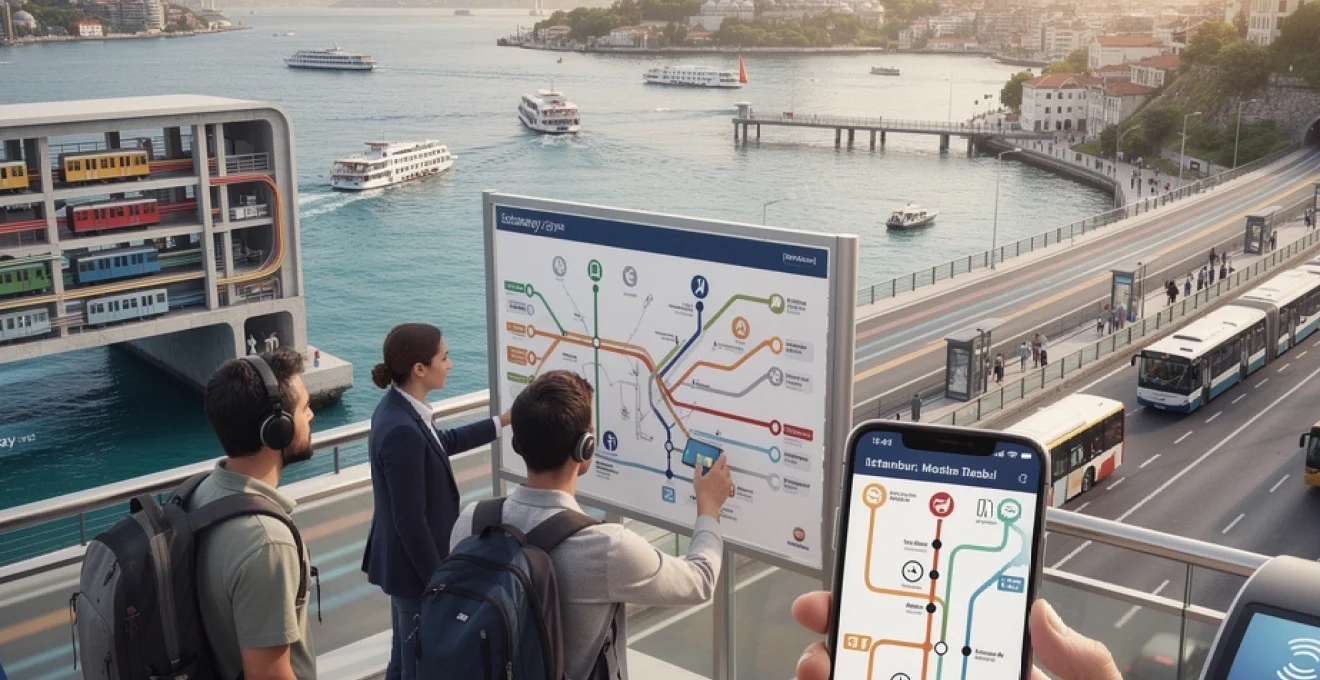
Istanbul public transport network overview and ticketing systems
Istanbul’s integrated transport network operates under the umbrella of Istanbul Metropolitan Municipality, coordinating eleven distinct metro lines, over 500 bus routes, multiple ferry services, and various rail connections. The system operates with remarkable punctuality, with metro services achieving 98.7% on-time performance and buses maintaining 89% reliability during peak hours. This comprehensive network ensures that virtually every corner of the city remains accessible through public transport, from the historic Sultanahmet district to the modern business centres of Levent and Maslak.
The backbone of this system relies on seamless integration between different transport modes. Passengers can transfer between metro, bus, tram, and ferry services using a single payment method, with strategically positioned interchange stations facilitating smooth transitions. Major hubs like Yenikapı serve as multi-modal terminals where metro, rail, and ferry services converge, handling over 200,000 passenger transfers daily during peak periods.
Istanbulkart digital payment integration and Top-Up methods
The Istanbulkart represents the cornerstone of Istanbul’s ticketing revolution, functioning as a contactless smart card that grants access to all public transport services throughout the city. Priced at 70 Turkish Lira for the physical card, this reusable payment method offers significant cost savings compared to individual ticket purchases, with single journeys costing approximately 17 Turkish Lira using the card versus 25 Turkish Lira for paper tickets.
Digital integration has expanded the card’s functionality beyond simple transport payments. Modern Istanbulkart systems accept contactless credit card payments and mobile wallet applications, allowing tourists to bypass the physical card entirely. The Istanbul Metropolitan Municipality’s mobile application enables real-time balance checking, journey history tracking, and remote top-up capabilities, transforming the traditional transport card into a comprehensive digital travel companion.
Bigg mobile application features and Real-Time journey planning
The BiGG mobile application serves as Istanbul’s official journey planning platform, integrating real-time data from all transport modes to provide accurate arrival predictions and optimal route suggestions. This sophisticated system processes over 2.3 million journey queries daily, utilizing artificial intelligence algorithms to account for traffic conditions, weather impacts, and service disruptions when calculating travel times.
Advanced features include multi-modal route optimization, where the application suggests combinations of metro, bus, and ferry services to minimize total journey time. The platform’s accessibility features provide audio announcements and visual aids for passengers with disabilities, whilst its offline functionality ensures route information remains available even without internet connectivity. Integration with popular mapping services allows users to seamlessly transition between journey planning and navigation phases.
Metropolitan municipality transport zones and fare structure
Istanbul’s transport system operates on a simplified flat-rate structure within the metropolitan area, eliminating the complexity of zone-based pricing found in many international cities. This approach ensures predictable costs for passengers, with standard metro, tram, and bus journeys charged at uniform rates regardless of distance travelled within city boundaries. Cross-Bosphorus services, including the Marmaray tunnel and certain ferry routes, carry premium charges reflecting their specialized infrastructure requirements.
Discounted fares apply to specific demographic groups, with students receiving 50% reductions, senior citizens over 60 qualifying for free transport, and registered disabled passengers accessing complimentary services. Tourist-
Tourist-oriented passes, including short-term transport cards and museum bundles, offer additional savings for intensive travel over 1–5 days. While these products often include unlimited public transport and priority access to major attractions, you should always compare their total cost with your planned itinerary; for some visitors, a standard Istanbulkart with pay-as-you-go credit remains the most economical choice.
Contactless payment options and tourist card alternatives
For visitors who prefer not to manage a separate transport card, Istanbul’s public transport network increasingly supports direct contactless payments. On many metro, tram, and bus gates, you can tap a contactless bank card or compatible smartphone wallet instead of an Istanbulkart. The system deducts a flat single fare per ride, which is usually higher than the rate offered with a standard card and does not always apply transfer discounts between modes.
Tourist cards provide a middle ground between flexibility and simplicity. The Istanbul City Card and similar passes are designed as time-limited products, typically valid for 1, 3, 5, 7, or 15 days, and often include unlimited journeys on metro, tram, bus, Marmaray, and public ferries during their validity. These cards are especially useful if you plan to visit multiple districts in a short period and do not want to track individual fares or balances, though they become less cost-effective for slower-paced trips.
When comparing contactless payments with tourist cards, consider how often you will cross the Bosphorus, use longer-distance commuter lines, or travel during peak sightseeing days. Heavy users usually benefit from unlimited tourist passes, while occasional riders can rely on a regular Istanbulkart or direct card payments. Regardless of the method you choose, Istanbul’s unified validation system ensures that you can access almost every transport mode with a single tap.
Metro system navigation: M1 to M11 line operations
Istanbul’s metro system forms the backbone of fast urban mobility, particularly during rush hour when surface traffic slows to a crawl. Eleven operational lines, from M1 through M11, now cover over 300 kilometres, with average weekday ridership exceeding three million passengers. Trains typically run every 3–8 minutes during peak times and every 7–10 minutes off-peak, making the metro the most reliable option for crossing long distances within the city.
All metro lines are clearly colour-coded and signed in both Turkish and English, which makes navigation manageable even on a first visit. Interchange stations such as Yenikapı, Taksim, Gayrettepe, and Üsküdar are designed as multi-level hubs, allowing you to transfer between lines without exiting the paid area. If you think of the metro network as the “express backbone” of Istanbul public transport, buses, trams, and ferries then act as the finer capillaries reaching individual neighbourhoods.
Marmaray cross-continental rail connection and station transfers
The Marmaray line is Istanbul’s engineering showpiece: a cross-continental commuter rail tunnel running beneath the Bosphorus and linking the far western suburbs at Halkalı with Gebze on the eastern fringe. Operating from around 06:00 to midnight, this line dramatically shortens travel times between Europe and Asia, turning what used to be long bridge or ferry journeys into a swift underground crossing of just a few minutes. Trains are frequent, with intervals of 5–10 minutes during the day and slightly longer at night.
Key stations for visitors include Yenikapı, Sirkeci, Üsküdar, and Ayrılık Çeşmesi. Yenikapı connects Marmaray with M1 and M2, forming one of the city’s most important interchange hubs, while Sirkeci places you within walking distance of Eminönü ferries and the historic peninsula. On the Asian side, Üsküdar offers easy access to coastal promenades and bus routes, and Ayrılık Çeşmesi links directly to the M4 line to Kadıköy and Sabiha Gökçen Airport. When planning cross-continental journeys, you can treat Marmaray as a high-capacity “spine” and then branch off onto local lines at these transfer points.
Fares on Marmaray are distance-based rather than flat, with your Istanbulkart initially debited for the maximum segment and then partially refunded at exit depending on how many stations you have travelled. For example, trips of up to seven stations incur the lowest tier, while long journeys across most of the line reach the top tier. This structure encourages you to use the line efficiently while still offering competitive pricing for commuters who rely on it daily.
M2 golden horn metro line: vezneciler to hacıosman route
The M2 line, often referred to as the Golden Horn or “backbone” line, is one of the most important routes for visitors navigating public transport in Istanbul. Running from Yenikapı in the south to Hacıosman in the north, it passes under the Golden Horn and connects historic districts with modern commercial centres. Stations such as Vezneciler, Haliç, Şişhane, Taksim, Osmanbey, and Levent provide direct access to key business, shopping, and nightlife areas.
For travellers staying in or near Sultanahmet, Vezneciler and Haliç are the most strategic entry points to M2, offering quick transfers from the T1 tram or short walks from the old town. From Taksim, the F1 funicular allows you to descend to Kabataş for ferries and trams, effectively linking M2 with maritime services and the historic tram network. Moving further north, Levent, 4. Levent, and İTÜ Ayazağa serve the city’s business districts and major shopping centres, including Kanyon and Metrocity.
Trains on M2 typically operate between 06:00 and 00:00, with some extended night services on weekends and public holidays. If you are planning to cross from the historic peninsula to areas like Beyoğlu, Nişantaşı, or Maslak, using M2 often cuts journey times in half compared with buses stuck in surface traffic. Think of M2 as your “express elevator” between old Istanbul around the Golden Horn and the modern neighbourhoods spreading north along the Bosphorus.
M1 airport line: atatürk and sabiha gökçen connectivity
The M1 line historically linked the former Atatürk Airport with Aksaray and Yenikapı, acting as the primary rail connection between international flights and the city centre. Although Atatürk has since closed to commercial passenger flights, M1A and M1B remain vital urban corridors, connecting dense residential quarters, bus terminals, and transfer hubs. Travellers still use these branches to reach major intercity bus stations and transfer onward via M2 or Marmaray.
Current airport connectivity has shifted to newer lines, with M11 serving Istanbul Airport (IST) and M4 extending to Sabiha Gökçen (SAW). However, understanding the M1 corridor is useful for those staying in neighbourhoods like Zeytinburnu, Otogar, or Yenikapı, where quick transfers to tram and rail services are essential. In practice, you might combine M1 with the T1 tram at Zeytinburnu or with M2 at Yenikapı to reach the historic peninsula or modern districts more efficiently.
For travellers arriving at Istanbul Airport or Sabiha Gökçen, airport shuttles and dedicated metro lines now replace the earlier dependency on M1A. Yet the line still functions as a critical inner-city connector, particularly for residents and long-distance bus passengers. When planning journeys that involve major bus terminals or older residential areas west of the historic core, keeping M1 in mind helps you avoid unnecessary taxi rides.
M4 Kadıköy–Tavşantepe line and asian side integration
The M4 line is the backbone of public transport on Istanbul’s Asian side, running from the coastal hub of Kadıköy through residential districts to Tavşantepe and beyond, with a branch extended to Sabiha Gökçen Airport. This line is essential if you are staying in Kadıköy, Moda, or along the eastern suburbs, providing a fast alternative to often congested surface routes. Trains operate from early morning to around midnight, with frequency similar to M2 on the European side.
At Kadıköy, M4 connects seamlessly with extensive bus networks, metrobus services at nearby Uzunçayır, and frequent ferries to Eminönü, Karaköy, Beşiktaş, and Kabataş. This makes Kadıköy one of the most important multi-modal hubs in the city, functioning as the Asian counterpart to Yenikapı. Travelling further east, stations such as Acıbadem, Ünalan, and Bostancı provide access to residential zones, shopping centres, and coastal promenades used by locals for evening walks.
The extension to Sabiha Gökçen Airport has transformed how visitors access the Asian-side airport, significantly reducing travel times and making late-night or early-morning flights more manageable. When combined with Marmaray at Ayrılık Çeşmesi or ferry connections at Kadıköy, M4 allows you to travel from central European districts to SAW with just one or two efficient transfers. For many travellers, this line is the key to integrating Asian-side exploration—such as Üsküdar, Kadıköy, and the Princes’ Islands ferries—into a wider Istanbul itinerary.
Bus rapid transit and metrobüs corridor mastery
While the metro offers speed and reliability underground, Istanbul’s bus rapid transit (Metrobüs) system provides a powerful alternative on dedicated surface corridors. Running along the main east–west axis, Metrobüs uses reserved lanes in the centre of the highway, allowing articulated buses to bypass regular traffic jams. This system carries over 800,000 passengers per day, demonstrating how crucial it is for cross-city commutes between outer districts and the city’s core.
Stations along the Metrobüs line are elevated and accessed via pedestrian bridges, with platform-style boarding that resembles light rail more than conventional buses. All stops accept Istanbulkart, and services operate 24/7, with especially high frequency during peak hours. If you imagine Istanbul’s transport as a circulatory system, Metrobüs functions like a high-pressure artery running parallel to the metro network, particularly useful when rail lines are busy or undergoing maintenance.
34 avrasya metrobüs route: beylikdüzü to söğütlüçeşme navigation
The flagship Metrobüs route, often labelled with variants of the 34 code such as 34AS or 34BZ, runs from Beylikdüzü on the European outskirts to Söğütlüçeşme on the Asian side. This continuous corridor crosses the Bosphorus via the 15 July Martyrs Bridge and connects dozens of districts along the way. For residents of western suburbs like Avcılar and Beylikdüzü, Metrobüs is frequently the fastest way to reach the city centre, even compared to private car travel.
Key interchange points along the line include Cevizlibağ (connection to T1 and M1), Mecidiyeköy (M2 and future M7), and Zincirlikuyu (buses to Levent and Beşiktaş), making it easy to switch between rapid bus and metro. On the Asian side, Söğütlüçeşme provides access to M4 and the Kadıköy district, offering onward routes to SAW airport and coastal ferries. You can think of this route as a “surface metro” that shadows the inner ring of the city while reaching far-flung neighbourhoods the underground network has yet to serve.
When using Metrobüs, be prepared for heavy crowding during rush hours, particularly at major transfer stations. Boarding from the rear or middle doors can sometimes be faster, and knowing your destination in advance helps you position yourself near the correct exit side. Because services run all night, this corridor is also a valuable backup when metro lines close around midnight but you still need to cross the city.
IETT public bus network and route planning via moovit
Beyond Metrobüs, Istanbul’s conventional bus network, operated by IETT and private partners, covers more than 500 lines and thousands of stops across both continents. These routes fill in the gaps between metro stations, ferry piers, and residential areas, ensuring that even hillside neighbourhoods and narrow streets remain connected. However, because buses share road space with cars, travel times can fluctuate significantly based on traffic conditions.
To navigate this complex network, many locals rely on journey-planning apps such as Moovit, Trafi, and the official IETT application. These tools provide real-time arrival estimates, route alternatives, and crowding information, making bus travel less intimidating for newcomers. If you are unsure whether to take a bus or metro, checking these apps can reveal which option will get you to your destination faster at that particular moment.
When boarding any IETT bus, you validate your fare by tapping your Istanbulkart on the reader near the driver; cash is not accepted. Stop announcements are displayed on interior screens and, on many lines, announced over speakers, but having your destination pinned in a navigation app adds an extra layer of confidence. Buses are ideal for reaching local markets, out-of-the-way viewpoints, or residential districts where metro lines do not yet extend.
Express bus services: 15F taksim and airport shuttle connections
Express bus lines complement the standard network by offering limited-stop services on busy corridors. Routes like 15F, connecting coastal suburbs on the Asian side with central areas, are designed to reduce travel times for commuters who would otherwise face numerous intermediate stops. These services are especially popular during peak hours, when saving even 10–15 minutes can make a noticeable difference in daily routines.
Airport shuttle buses, operated under the Havaist and municipal brands, provide direct connections between Istanbul Airport (IST), Sabiha Gökçen (SAW), and major nodes such as Taksim, Beşiktaş, Kadıköy, and Yenikapı. Equipped with luggage storage, Wi-Fi, and comfortable seating, they serve as a bridge between long-distance air travel and the urban transport grid. You can pay for most of these shuttles using Istanbulkart, contactless bank cards, or mobile apps, making them easy to integrate into your broader journey.
When deciding between express buses and the metro for airport transfers, consider both travel time and your luggage situation. Metro lines can be faster and less affected by road conditions, but shuttles may offer a more straightforward, single-seat ride to central hubs, particularly late at night or with heavy bags. Combining an airport bus with metro or tram lines often yields the most efficient and comfortable route.
Minibüs dolmuş system and neighbourhood feeder routes
Beyond formal bus routes, Istanbul’s dolmuş and minibüs services provide flexible, semi-formal shared taxis that operate on fixed routes but allow passengers to board and alight almost anywhere along the way. These yellow or blue-green vehicles are especially common along coastal roads, between district centres, and in hilly neighbourhoods where full-sized buses struggle to navigate. Fares are paid in cash directly to the driver, and prices are typically posted near the windscreen.
Because dolmuş vehicles do not require pre-purchased tickets or cards, they are particularly useful for spontaneous short journeys between nearby districts. For example, you might use them to travel from Beşiktaş to Taksim, from Kadıköy to Üsküdar, or between local hubs on the Asian side. In practice, they function as feeder services, channelling passengers from residential side streets to main metro or bus corridors.
For newcomers, the main challenge lies in understanding routes and signalling stops; passengers usually call out “inecek var” (someone wants to get off) or simply state their desired stop to the driver. Observing how locals behave on your first ride can be helpful, much like learning the unwritten rules of a new workplace. Once you are familiar with a particular corridor, dolmuş services can become one of the quickest and most authentic ways to move around Istanbul’s neighbourhoods.
Bosphorus ferry services and maritime transport integration
Istanbul’s ferries are more than just a scenic tourist experience; they are a vital component of the city’s daily commute, carrying hundreds of thousands of passengers across the Bosphorus and along the Golden Horn. Public ferries operated by Şehir Hatları, alongside private operators such as Turyol and Dentur, connect major piers including Eminönü, Karaköy, Beşiktaş, Kabataş, Kadıköy, and Üsküdar. For many residents, the ferry is the most pleasant way to cross continents, combining fresh air, city panoramas, and predictable schedules.
All municipal ferries accept Istanbulkart, with fares slightly higher than a standard metro ride but still highly affordable. Services typically run from early morning (around 06:00–07:00) until late evening, with frequency varying from every 10–20 minutes on busy routes to hourly on less-travelled ones. Integrating ferries into your itinerary can be compared to adding a scenic “express lane” to your day, allowing you to bypass bridge traffic while enjoying iconic views of the skyline.
In addition to cross-Bosphorus routes, there are longer lines that travel up the strait toward neighbourhoods like Beşiktaş, Arnavutköy, and Sarıyer, as well as services to the Princes’ Islands from Kabataş, Beşiktaş, Kadıköy, and Bostancı. These longer trips offer a cost-effective alternative to dedicated Bosphorus cruises, especially if you time your journey for golden hour or sunset. By combining ferries with nearby tram and metro stations—such as T1 at Eminönü or F1 at Kabataş—you can build multi-modal routes that are both efficient and memorable.
Funicular railways and cable car systems: tünel to pierre loti
Istanbul’s topography, marked by steep hills and deep valleys, makes vertical transport almost as important as horizontal movement. Funiculars and cable cars fill this gap, linking waterfront districts with elevated neighbourhoods that would otherwise require strenuous climbs. These systems are fully integrated into the public transport network, accepting Istanbulkart and following regular timetables coordinated with metro, tram, and ferry services.
From a traveller’s perspective, funiculars and teleferik lines are not only practical but also offer unique perspectives on the city’s urban landscape. They act like short, vertical “shortcuts” that turn a 20-minute uphill walk into a 90-second ride. When planning your journeys, adding these lines to your route can dramatically reduce travel fatigue, especially on days when you are visiting multiple hilltop sites.
Historic tünel underground railway and beyoğlu district access
The Tünel funicular, operating between Karaköy and Beyoğlu since 1875, is one of the oldest underground railways in the world and a living piece of transport history. Covering just 573 metres in about 90 seconds, it saves you from a steep climb from the waterfront up to the end of İstiklal Caddesi. Despite its short length, Tünel carries thousands of passengers daily, many of them commuters heading to offices and shops in Beyoğlu.
At the lower station in Karaköy, Tünel connects seamlessly with the T1 tram and nearby ferry piers, making it easy to transfer from historic peninsula or Asian-side routes. At the upper station, you arrive near historic Galata, from where you can walk to Galata Tower, continue along İstiklal Street toward Taksim, or transfer to the nostalgic tram (T2). Using Tünel can feel like stepping into a time capsule, yet it remains an efficient and modern part of the city’s integrated public transport in Istanbul.
As with other rail modes, you simply tap your Istanbulkart at the gate and board the next departing train; departures are frequent, especially during business hours. If you prefer to conserve energy for exploring Beyoğlu’s side streets and galleries rather than tackling its steep approach, incorporating Tünel into your route is a smart strategy.
Eyüp–pierre loti teleferik cable car system
The Eyüp–Pierre Loti cable car (TF2) offers both practical elevation gain and one of the most picturesque viewpoints in Istanbul. Connecting the Eyüp Sultan Mosque area on the Golden Horn with the hilltop Pierre Loti café and cemetery, this short ride lifts you above the rooftops and trees for sweeping views toward the old city. For many visitors, it is an unexpected blend of everyday transport and sightseeing attraction.
The lower station is easily reached by the T5 tram line or various bus routes serving Eyüp, making it simple to integrate into a larger day of exploring the Golden Horn districts such as Fener and Balat. At the upper station, walking paths lead through historic cemeteries to terraces and cafés overlooking the water, where you can pause before continuing your journey. Like other teleferik lines, TF2 accepts Istanbulkart and runs at frequent intervals throughout the day.
Because the cable cars operate as small cabins with limited capacity, queues can form at peak times, especially on weekends and during sunset hours. Planning your visit for mid-morning or early afternoon can help you avoid the longest waits while still enjoying excellent visibility. In terms of effort saved versus time invested, this system is one of the most efficient ways to access a high vantage point over Istanbul.
Maçka–taşkışla funicular and nişantaşı shopping district
The Maçka–Taşkışla cable-drawn system, sometimes described as a funicular-like cable car, provides a quick aerial connection between the green slopes of Maçka Park and the architectural complex around Taşkışla, near Taksim. Spanning a valley rather than climbing a steep slope, it acts as a horizontal skybridge across one of Istanbul’s inner-city ravines. The ride itself offers striking views of parkland, residential buildings, and parts of the Bosphorus beyond.
For shoppers and café-goers, this line is particularly useful because it links easily with the Nişantaşı district, one of Istanbul’s most stylish neighbourhoods. From the Maçka side, a short walk takes you into streets lined with boutiques, design stores, and restaurants. On the Taşkışla side, you are within walking distance of Taksim Square and can connect to M2, the nostalgic tram, or the F1 funicular to Kabataş.
Like other specialised lines, the Maçka–Taşkışla route accepts Istanbulkart and runs at regular intervals throughout the day, with short waiting times even in busier periods. If you think of this system as a moving balcony between two hillside terraces, you get a sense of its dual role as both a time-saver and a scenic interlude in your day. Incorporating it into a walking route between Taksim, Maçka Park, and Nişantaşı can turn a potentially tiring climb into a relaxed, multi-level stroll.
Advanced journey planning and multi-modal transfer strategies
With so many transport options available, the real art of navigating public transport in Istanbul lies in combining modes intelligently. A well-planned journey might include a short bus ride to a metro hub, a rapid metro crossing under the Golden Horn, and a final ferry segment across the Bosphorus. Thinking in terms of “legs” and “hubs” rather than single direct routes helps you adapt quickly to traffic conditions, service changes, or last-minute itinerary shifts.
Before setting out, it is worth identifying a few strategic interchange points close to where you are staying—such as Yenikapı, Taksim, Kadıköy, Üsküdar, or Beşiktaş—and using them as anchors for your daily plans. From these hubs, multiple lines radiate outward, giving you a range of alternatives if one route is delayed or overcrowded. For example, if the tram is congested leaving Sultanahmet, you might walk to Eminönü and catch a ferry to Karaköy or Kadıköy instead.
Digital tools are indispensable for advanced planning. Journey-planning apps that integrate metro, bus, ferry, and funicular data allow you to experiment with different combinations before you leave your hotel. You can compare travel times via metro plus ferry versus bus plus Marmaray, or check how much walking each option requires. Over time, you will start to build a mental map of preferred routes, much like learning shortcuts in your own neighbourhood.
One effective strategy is to avoid crossing major bottlenecks at peak times whenever possible. For instance, if you know you must be on the Asian side in the afternoon, consider travelling there late morning and exploring local districts before your appointment, rather than attempting a cross-Bosphorus transfer during the evening rush. Similarly, using vertical links—such as funiculars and cable cars—reduces physical strain and keeps you fresher for sightseeing, meetings, or social events.
Ultimately, mastering multi-modal transfers in Istanbul is a bit like learning a new language: at first you rely on maps and translation tools, but with practice, switching between metro, bus, ferry, and funicular becomes instinctive. By approaching the network as an interconnected whole rather than a collection of separate lines, you gain the freedom to move efficiently through one of the world’s most dynamic cities, turning complex journeys into smooth, well-orchestrated routines.